Showing posts with label C and O Canal. Show all posts

Thursday, March 19, 2015

Civil War Views: Battery Martin Scott

This week's "Civil War Views" takes another look at the strategic Potomac River crossing of Chain Bridge. The defenses around the bridge became the subject of many wartime photographs and sketches. Aside from a lower battery at the Washington end of the bridge, another gun emplacement, known as Battery Martin Scott, occupied the heights immediate above. The battery was initially composed of two 32-pounders and one 8-inch seacoast howitzer mounted en barbette. Two 6-pounder rifled guns apparently replaced these three artillery pieces.

A few months ago, I discovered that the New York Public Library has made available a collection entitled, Sketches for Frank Leslie's Illustrated Newspaper : 138 original drawings of the Civil War by staff artists, 1861-1864. This set of drawings contains many fascinating images of Washington and environs during the early days of the Civil War. Among the drawings is this sketch by Arthur Lumley of Battery Martin Scott:

"High Battery at the Chain Bridge" (courtesy of New York Public Library)

As my friend and fellow blogger Craig Swain has pointed out, the three guns depicted here aren't very precise renderings of the actual armaments at the battery. Below the battery, the wooden span of Chain Bridge crosses the Chesapeake & Ohio Canal and the more distant Potomac River. A mule team pulls a boat along the canal. The gun position offers a commanding view of the Virginia shoreline and hills. Incidentally, Forts Marcy and Ethan Allen protected the approaches to Chain Bridge on the Virginia side. They cannot be seen here, but sat on the hills opposite the battery.

Lumley's sketch appears as an engraving in the November 9, 1861 issue of Frank Leslie's:

(courtesy of archive.org)
The paper said the following about the illustration of Battery Martin Scott:
WAR is a fearful and wonderful teacher of topography. Places and objects which a few months ago were known only to travellers, or those dwelling on the spot, are now "familiar as household roads." Washington and its adjacent localities  are to the majority of readers now as well known to them as to their denizens. Among the more prominent spots is the Chain Bridge, which crosses the Potomac river at the Little Falls, about five miles above Washington City. It is the direct route from the camp at Tenellytown and Georgetown to Lewinsville and Langley, and is consequently a position of much importance. Our readers will perceive that the National Government has erected a powerful battery on the Maryland side, so as to sweep with utter destruction any hostile force. Now that the Federal Capital is safe, we trust Kentucky, Missouri and Tennessee will be rescued from the rebel hordes, whose presence is unwelcome to the people of those States as it is humiliating to the National cause. (at 389-90.)
Today, I'd venture to speculate that once again, few outside the Washington area know the Chain Bridge! But Lumley's sketch reminds us of  the importance of such places over 150 years ago. So the next time you cross the river there, whether because you commute across the bridge daily, or because you are on a vacation in the area, think back to the sketch and engraving as you look up at the bluffs overlooking the Potomac.

Source

Benjamin Franklin Cooling III & Walton H. Owen II, Mr. Lincoln's Forts: A Guide to the Civil War Defenses of Washington (2010 ed.);  Frank Leslie's Illustrated Newspaper, Nov. 9, 1861; OR, 1:21:1, 911.

Friday, March 6, 2015

Civil War Views: Lower Battery at Chain Bridge

As readers may have noticed, things are a bit "quiet along the Potomac" here on the blog! With a newborn and increased responsibilities on the home front, the time I have for research and writing each night has dwindled considerably. That said, I have many new topics in the pipeline, and much of the related research is substantially completed, so I hope that I will be able to post some original, in-depth content here as we head into the spring and summer. In the meantime, I am launching a new visual series on the blog called, "Civil War Views."

I've recently come across some amazing drawings and photographs of wartime Washington, DC and Northern Virginia. It seems that every day that the Library of Congress, the National Archives, and other institutions are making more and more visual content available on the Internet. Rather than just post a newly discovered image on Facebook or Twitter, I felt it would be nice to offer a little context about the photograph, sketch, or engraving in a good, old-fashioned blog post! So now, without further ado, here is the first installment. . . .

I've written extensively about Chain Bridge over the years. Many of my posts have focused on the defenses that the Union Army erected to protect this key Potomac River crossing. I particularly like this relatively obscure photograph of the Lower Battery at Chain Bridge:

"Battery at Chain Bridge, Washington, D.C. 1862" (courtesy of the Library of Congress).

The photograph shows the battery that was established in 1861 on the Washington side of Chain Bridge. Gun crews pose next to a 12-pounder howitzer (l) and 24-pounder howitzer (r). (Thanks to my friend and fellow blogger Craig Swain for helping to verify!)  The artillery is positioned to fire through embrasures in the earthwork. A few soldiers stand guard, while others mill around at the end of the bridge. The Chesapeake & Ohio Canal is visible to the right side of the photograph. Incidentally, another gun emplacement, known as Battery Martin Scott, was located on the bluffs above the battery pictured here. More on that one in a future Civil War Views post!

Source

Benjamin Franklin Cooling III & Walton H. Owen II, Mr. Lincoln's Forts: A Guide to the Civil War Defenses of Washington (2010 ed.).

Thursday, January 12, 2012

Hell on DC-Area Roads, Civil War-Style

Commuting in the Washington, DC metro region is certainly no walk in the park.  My daily drive of nine miles home from the city can take up to an hour or more on any given day.  Washington consistently wins top honors for having the worst traffic in the country.  And bad weather like snow turns the roads into a sheer commuter nightmare.  The study of history, however, often puts things in perspective, and that certainly was the case when I came across a Civil War-era account of a trip over roughly the same route I follow everyday.

In January 1862, Hugh Young, the editor of the Wellsboro (Pa.) Agitator, came to Washington City.  He intended to pay a visit to the Pennsylvania Reserves at Camp Pierpont in Langley.  Going to the Old Dominion in those days required a military pass, so Young headed first to the Provost Marshal's Office.  Here, "with the assistance of a line . . . vouching for our loyalty" from Speaker of the House Galusha Grow of Pennsylvania, he procured "a pass into the land of Dixie." 

Young headed next to the Langley Stage Office at the Clay Hotel to find transportation across the Potomac to the camps.  From the hotel situated on Pennsylvania Avenue between 3rd and 4 1/2 Streets,* a "diligence" or "long covered wagon with hard seats" ran the eight miles to Langley twice a day for a fare of one dollar.  The editor boarded the wagon with his traveling companion and around a dozen others.  Now the fun really began.

As Young described the journey:
. . . soon we were on the road to the Chain Bridge. And such a road! Properly speaking, it was a canal filled to the depth of six to twelve inches with a sloshy mud, through which the horses waded with a slow and patient gait.**

Section of 1862 Union Army map of N.E. Virginia and the Vicinity of Washington showing likely route taken by Young from the Clay Hotel in Washington to Langley, Virginia (courtesy of Library of Congress).  A modern view of approximately the same route can be found here.

Along the way, soldiers stopped the wagon to examine the passengers' passes, likely causing additional delay.  The last check occurred at the entrance to the Chain Bridge.  Incredibly, the editor recognized the soldier as a Simon Doorlacher from Wellsboro, who was serving with the Tioga Invincibles, or Company H of the 6th Pennsylvania Reserves.  After crossing Chain Bridge, the wagon headed up the Leesburg-Georgetown Turnpike and traveled a few more miles to Langley, where it was already "quite dark."  All told, Young seemed pleased that the trip had taken "just four hours."

"Washington, D.C. Chain Bridge over the Potomac; Chesapeake and Ohio Canal in foreground (courtesy of Library of Congress)
My own route home is very similar, but starts a little further west at 17th and G Streets, N.W.  I avoid the heart of the city and Georgetown by taking the Whitehurst Freeway and drive along Canal Road until I hit Chain Bridge.  Rt. 123 on the other side takes me to a point just beyond Langley.  This route can be nerve-wracking and time-consuming, but I have nothing on the editor of the Agitator.  The next time I feel myself becoming annoyed and impatient with my commute, I will think back 150 years and remember that things could be much worse.

Notes
*Today, 4 1/2 Street, N.W. does not intersect with Pennsylvania Avenue, N.W.  The hotel was likely located around the present-day site of the Federal Courthouse.

**The diligence probably traveled through the streets of Washington City, most likely Pennsylvania Avenue, and into Georgetown. From there, it may have taken the carriage road along the Chesapeake & Ohio Canal to Chain Bridge. John G. Barnard, former chief engineer to the Army of the Potomac, described this carriage road as "excellent" in his report on the defenses of Washington.  (Barnard 2.)  The editor of the Agitator may have disagreed with him on this point!

Sources
John G. Barnard, A Report on the Defenses of Washington to the Chief of Engineers, U.S. Army (1871); Johnson's Map of Georgetown and the City of Washington, 1862; Washington National Republican, Mar. 4, 1862; Wellsboro (Pa.) Agitator, Jan. 29, 1862.

Friday, July 8, 2011

Aqueduct Bridge over the Potomac: Yesterday and Today

My wife and I decided to take a walk along the Chesapeake & Ohio (C&O) Canal in Georgetown this past Memorial Day.  Our little attempt at exercise gave me the perfect opportunity to check out the remains of the Aqueduct Bridge, which are located next to the canal path in the vicinity of present-day Key Bridge.  Readers may recall that I have mentioned the Aqueduct Bridge in numerous posts over the past year.  This bridge was one of three river crossings into Virginia from the D.C. side of the Potomac at the time of the Civil War.

The Aqueduct Bridge dates to the antebellum period, when Alexandria comprised part of the federal District of Columbia.  Alexandria, a port city, desired to benefit from the trade that was moving along the C&O Canal to rival Georgetown.  In 1830, a group of Virginia merchants formed the Alexandria Canal Company.  They sought to extend the C&O Canal to the Virginia side of the Potomac River, and from there, to Alexandria.  The Aqueduct Bridge, known as the Alexandria Aqueduct or Potomac Aqueduct, was designed to carry the canal across the river. Construction on the bridge and the Alexandria Canal began in the early 1830s and was completed in 1843.  The bridge, an engineering marvel of the 19th century, cost a staggering sum of around one million dollars.  With the extension of the C&O Canal to Cumberland, Maryland in 1850, the Aqueduct Bridge played a key role in bringing coal from western Maryland to the the port at Alexandria. 

The Aqueduct Bridge featured prominently at the start of the Civil War.  Virginia voters officially approved secession on May 23, 1861, and in the early morning hours of May 24, Union soldiers moved to occupy Alexandria and Arlington Heights.  A Federal column including the 5th, 28th, and 69th New York crossed the Aqueduct Bridge into Virginia.  Not long afterward, the Union Army constructed Forts Corcoran, Bennet, and Haggerty to guard the approaches to Aqueduct Bridge from the Virginia side of the river.  These forts comprised part of what would become the ring of defenses built to protect Washington during the war. 

The Aqueduct Bridge from the Washington side, with the C&O Canal in the foreground, ca. 1862-65 (courtesy of Library of Congress).
In his A Report on the Defenses of Washington to the Chief of Engineers, U.S. Army (1871), Brevet Major General John Gross Barnard noted that the Union military decided that a "permanent and secure bridge connecting Washington with the Virginia shore" was preferable to the use of the Aqueduct Bridge to transport military supplies to Alexandria by way of the canal. Some officers, as well as the canal company, initially objected to the suspension of canal operations across the Aqueduct Bridge. A "boat bridge" was contemplated for military purposes, but proved an unrealistic alternative given concerns about water depth, flooding, ice, and currents. Barnard described the subsequent transformation of the Aqueduct Bridge:
The tow-path of the aqueduct did indeed furnish a narrow passageway to horsemen and footmen; but this was far from adequate to the military exigencies. Accordingly, early in the winter of 1861-'62, the water was shut off from the aqueduct and its trough converted into a double-track wagonroad, the floor being overlaid with 4-inch planks and long inclines, on trestles, forming connections with the roads on either side.
Eventually three blockhouses and a rifle trench were placed at the Virginia end of the Aqueduct Bridge. The head of the bridge was also enclosed with a stockade to protect more effectively against cavalry raids. The Union Army contemplated placing a shore battery in Georgetown to command the length of the bridge, but decided against this defensive measure.  A guard of one officer and thirty men usually covered each end of the Aqueduct Bridge.

One of the blockhouses near Aqueduct Bridge on the Virginia side (courtesy of Library of Congress).

Barnard, who oversaw the construction of the the defensive works around the nation's capital, concluded in his report that "the aqueduct served perfectly, throughout the entire period of the war, its new destination, and was recognized as an important and essential adjunct to the 'Defenses of Washington' and to the great military operations in Virginia."

Looking at the top of the remains of the Aqueduct Bridge's Washington abutment along the C&O Canal.  The canal entered here and crossed the Potomac. The Key Bridge dominates in the background.  The office buildings of Rosslyn, Virginia are visible across the Potomac River.

Another view of the Aqueduct Bridge during the Civil War (courtesy of Library of Congress).  This photograph was taken from across the Potomac in Virginia.  The Washington abutment is visible where the bridge hits the shore in Georgetown.

A side view of the Washington abutment.  The arch to the left was expanded in 1889 to accommodate the Washington branch of the Baltimore & Ohio Railroad. 

The bridge was returned to canal usage after the Civil War.  In 1923, the Aqueduct Bridge was closed when the Key Bridge was built next door, and in 1933, the old bridge was largely dismantled.  Today the remaining Washington abutment is a visible reminder of the existence of the Aqueduct Bridge and the place it occupied in the capital's Civil War history.

Wednesday, March 2, 2011

Civil War Forts of Arlington Tour, Part II: Fort C.F. Smith & Fort Bennett

As I wrote in my last post, this past Saturday I went on a tour of Civil War forts sponsored by Arlington County.  Our first stop was Fort Ethan Allen, close to the Chain Bridge over the Potomac.  The group headed next to Fort C.F. Smith Park (2411 24th Street N., Arlington VA 22207), where our guide, David Farner, is park manager.  The 19-acre park contains the remains of Fort C.F. Smith, as well as a walking trail, ornamental peace garden, and bird creek.  A 20th-century mansion on the grounds can be rented for weddings and other occasions.  The property was purchased by Arlington County in the mid-1990s.  This move prevented the site from falling into the hands of private developers who may have been less inclined towards preserving and interpreting the history of the property. 

Fort C.F. Smith

The Union Army built Fort C.F. Smith in early 1863 to extend the "Arlington Line" of forts in Alexandria (now Arlington) County to the Potomac River.  This installation, together with Forts Strong, Morton, and Woodbury, served to protect the Chesapeake & Ohio (C&O) Canal crossing at Aqueduct Bridge, near the current day Key Bridge.  Fort C.F. Smith also covered a tributary ravine of Spout Run that was not under the protection of Fort Strong's artillery.

The fort, built as a lunette with a west and south face, had a perimeter of 368 yards.  Of the two faces, only part of the west wall remains.  Although there were emplacements for 22 guns and four siege mortars, just16 guns and four mortars were installed.  Various buildings, including the mess hall, barracks, and officers' quarters were erected to the east of the fort, but these structures were torn down after the war, and no traces remain.  Fort C.F. Smith was garrisoned by troops from several regiments, including the 2nd New York Heavy Artillery, the 1st New Hampshire Heavy Artillery, and the 4th Massachusetts Heavy Artillery.
 
The fort was built on land belonging to Thomas Jewell.  The Union Army wrecked Jewell's home, which was painted a distinct red, to make way for the fort.  Initially called the "Fort at Red House," the fort was named after Major General Charles Ferguson Smith, who commanded soldiers under Ulysses S. Grant at Fort Donelson in February 1862. As the defeated Confederate force prepared to surrender, Smith advised that Grant ask the enemy for nothing less than "unconditional and immediate surrender." Grant obliged, and the "Unconditional Surrender" nickname stuck with Grant throughout the remainder of the war.  Smith died of complications from a seemingly minor non-combat leg injury in April 1862.
 

Major General C.F. Smith (courtesy of the Library of Congress)

Several features of Fort C.F. Smith are still visible, including the west wall and ditch, north magazine, gun platforms, and bombproof. 

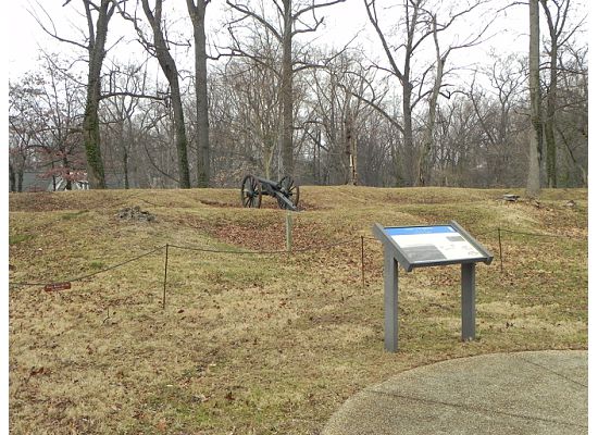
Looking towards the west wall and gun platforms.  A replica M1841 6-pounder occupies one of the emplacements. Visible in the foreground is a Civil War Trails marker, one of four historical markers on the property.

Co. F, 2nd New York Heavy Artillery along the west wall, August 1865.  This photograph was taken from the north magazine (courtesy of the Library of Congress). 


Remains of the north magazine near the west rampart of the fort.

A close-up view of the 6-pounder in an emplacement along the west wall.  A limber sits in front of the north magazine.

Well-preserved remains of gun placements along the west wall.

Looking along the west face of the fort towards the north.  The ditch is clearly visible below.

Remains of the western side of the bombproof.

Co. K, 2nd New York Heavy Artillery, in front of the east side of the bombproof. The timber was removed after the war, and today, only remnants of the dirt cover are visible.
Fort Bennett

After completing our tour at Fort C.F. Smith, we headed deeper into another residential neighborhood and parked around the 1600 block of 22nd Street N.  A historical marker tells the story of Fort Bennett, but no traces of the fort remain. The marker is actually located downhill from the original site of the fort, now buried underneath the suburban streets.  Arlington also runs  Fort Bennett Park, which overlooks the Potomac River and Georgetown.  We made a quick stop at the park to examine the terrain.


Fort Bennett Historical Marker, 22nd Street N., Arlington, Virginia.

In May 1861, the Union Army entered Virginia and began construction of the first defensive works. Fort Bennett, with a perimeter of just 146 yards and five artillery emplacements, was designed to protect the Aqueduct Bridge and lend support to nearby Fort Corcoran. Looking at the commanding position above the Potomac River and Key Bridge from Fort Bennett Park, I gained a good understanding of why the fort was built in this area. The fort's namesake is Captain Michael P. Bennett of the 28th New York Infantry, who directed its construction.

Close-up view from Fort Bennett Park across the Potomac to the surviving abutment of the Aqueduct Bridge in Georgetown.

View of Aqueduct Bridge from across the Potomac in Virginia, roughly in the same spot where the above photograph was taken (courtesy of the Library of Congress).
After this short stop at the Fort Bennett site, we set out for our final stop. Overall, I was very impressed by Fort C.F. Smith.  Along with Ft. Ward in Alexandria, Fort C.F. Smith is one of the best sites to visit in the Civil War defenses of Washington.  As the pictures indicate, the remains of the fort are very well preserved, and a visitor can really get a sense for the apprearance of the place during the war.  Fort Bennett represents the opposite extreme -- history lost to time and development.  At least a marker bears witness to what happend on the heights of Arlington nearly 150 years ago.